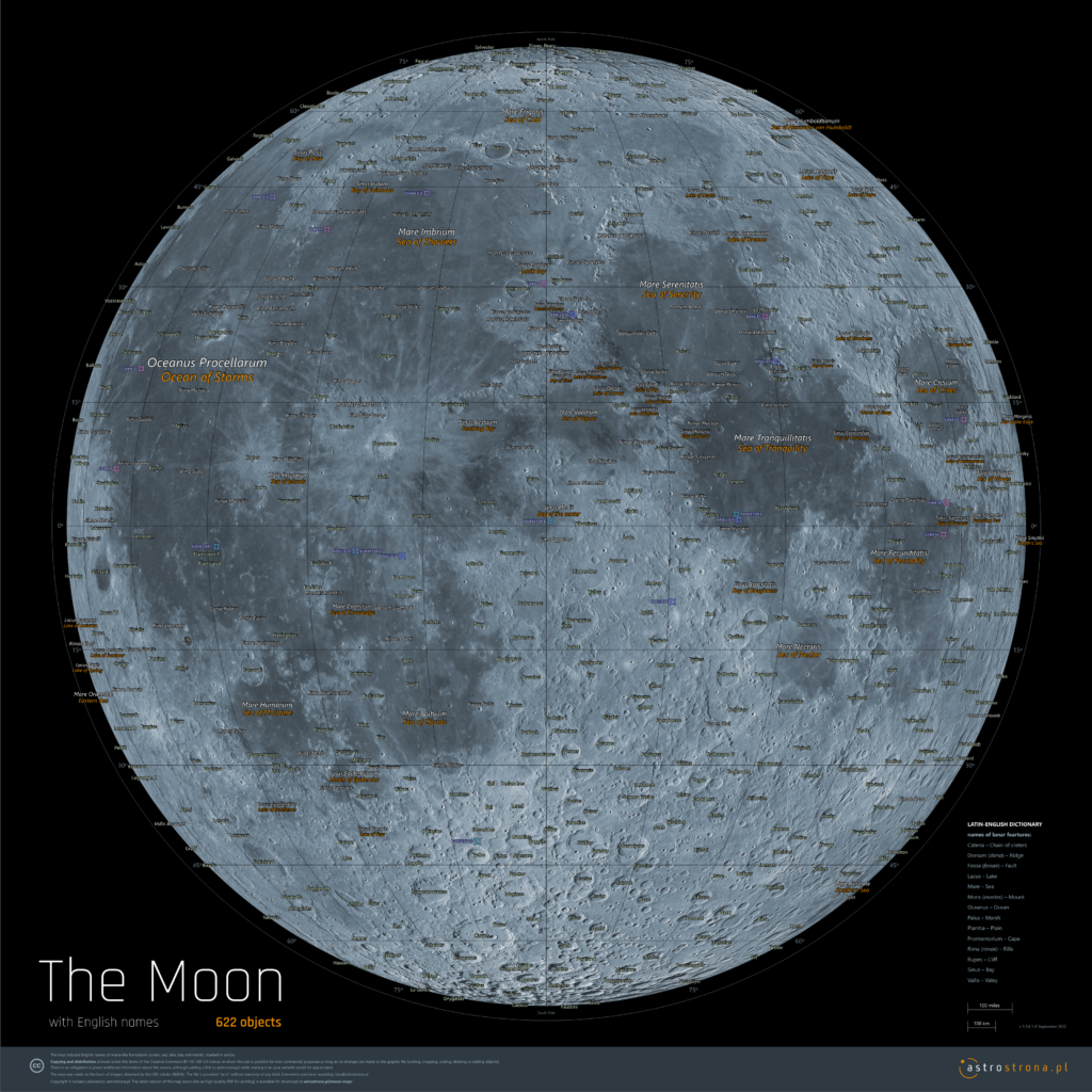
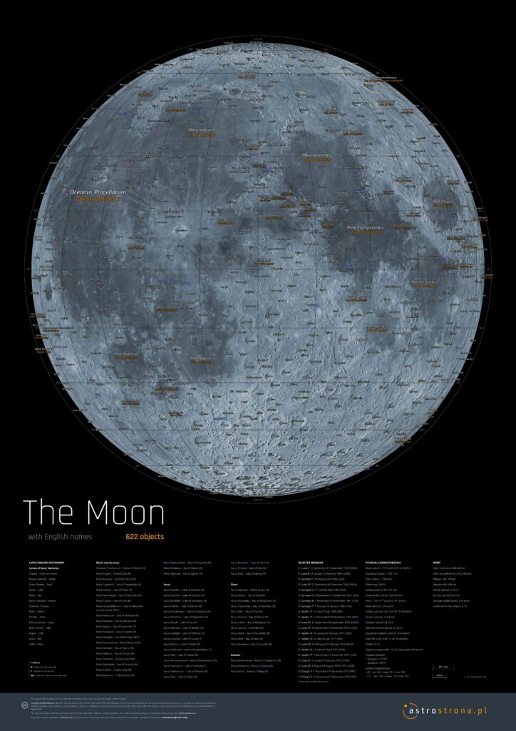
- Online map of the Moon with English names, made available as a single file.
- Includes over 600 terrain formations and sites on the near side of the Moon.
- Over 20 lunar missions landing sites
- Does not require learning and loading interactive interfaces.
- Available in two versions:
Screen: Download PNG | Print/Screen: Download PDF |
Before you print the Map or post it on the web, download the latest version from this website!
Current version: 1.3.6.1-E (September 2022).Also available in Polish version: Mapa Księżyca po polsku
1. On-screen version (PNG)

2. Print/on-screen version (PDF)
The PDF version allows for good print quality up to the size of B0 (1 × 1.4 m). Text elements retain a vector character, which guarantees the highest precision, they can also be searched using search engines built into PDF or WWW browsers (usually Ctrl + F).
The Moon Map contains layers that allow you to turn off the view of labels and the coordinate grid using the PDF viewer, and obtain a clean, photographic image of the Moon.
The bitmap presenting the surface of the Moon reaches a resolution of 150 dpi when printed in B0 size. This allows you to obtain a good quality detail using large-format plotter printing with a resolution of 360 and even 720 dpi. Objects in the file are saved in the RGB color space.
The PDF version is complemented by a glossary of Latin-English names, summary of the basic physical and orbital characteristics and a list of selected missions that successfully reached the lunar surface.
Alternatively you can also download the graphics prepared for the PDF version as a high-resolution bitmap (5039 × 7126 px, 5.9 mb)
English names
The Moon Map includes English names of maria-like formations (ocean, sea, lake, bay and marsh), marked in yellow. I did not translate all proper names, such as the names of ancient figures with English equivalents, or the names of some mountain ranges. I figured it would be a random choice, introducing additional chaos.
The Map uses images collected by the Lunar Reconnaissance Orbiter (NASA). I typed all the names by hand, and typos are my specialty, so I probably did not avoid them here. If you notice mistakes, have comments, suggestions – pleas write !
The Moon Map is provided „as is” without warranty of any kind.
Copying and distribution of the Map
is allowed under the terms of the Creative Commons BY-NC-ND 3.0 license (in short: distribution is possible for non-commercial purposes, provided that the author is identified and no changes are made to the work. There is no obligation to place additional information about the source, although adding a link to astrostrona.pl while sharing it on your website would be appreciated.
Commercial use of the Map
The legal status of the elements used to create the Map allows commercial use to be licensed. If you would like to sell your product using Map, offer wide-format prints, etc., please contact me .
![]()
